- ES Español (Latinoamérica)

- EN English

3.41. AR3B4 Heritage and Infrastructure (Mandatory)
- Semester: 9th Sem. Credits: 4
- Hour of this course: Theory: 4 hours; Practice: 4 hours;
- Syllabus:
 Español (Latinoamérica)
 English
- Prerrequisites:
- AR3B3 Facilities Management (8th Sem)
- ES Español (Latinoamérica)
- EN English
3.41.1. Justification Back to top
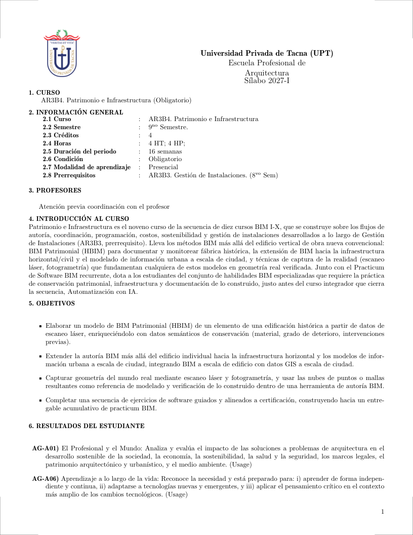
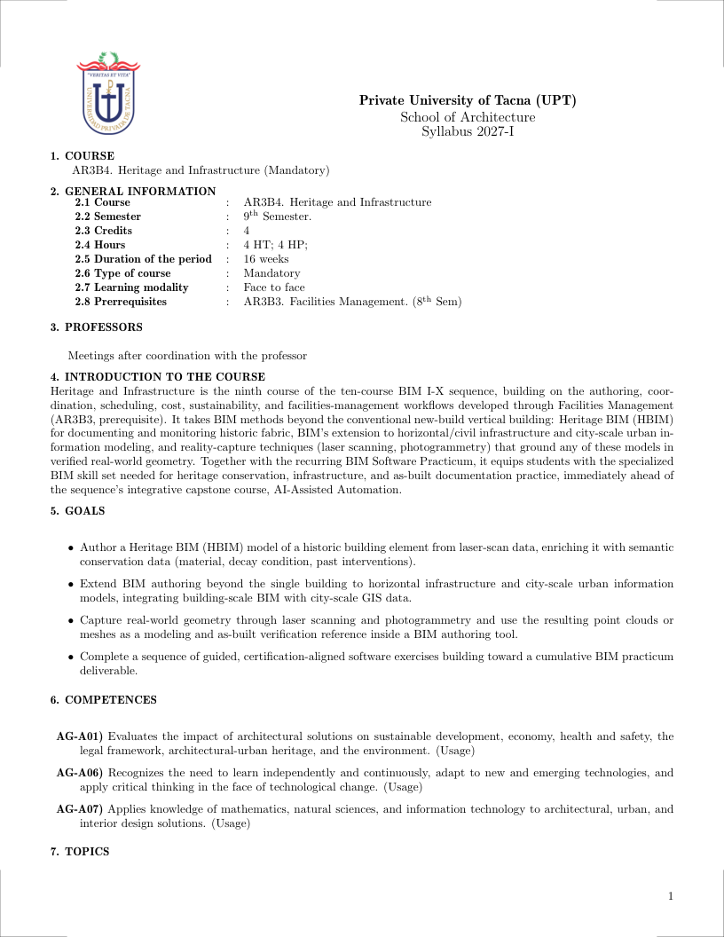
Heritage and Infrastructure is the ninth course of the ten-course BIM I-X sequence, building on the authoring, coordination, scheduling, cost, sustainability, and facilities-management workflows developed through Facilities Management (AR3B3, prerequisite). It takes BIM methods beyond the conventional new-build vertical building: Heritage BIM (HBIM) for documenting and monitoring historic fabric, BIM's extension to horizontal/civil infrastructure and city-scale urban information modeling, and reality-capture techniques (laser scanning, photogrammetry) that ground any of these models in verified real-world geometry. Together with the recurring BIM Software Practicum, it equips students with the specialized BIM skill set needed for heritage conservation, infrastructure, and as-built documentation practice, immediately ahead of the sequence's integrative capstone course, AI-Assisted Automation.
- ES Español (Latinoamérica)
- EN English
3.41.2. Generales Goals Back to top
- Author a Heritage BIM (HBIM) model of a historic building element from laser-scan data, enriching it with semantic conservation data (material, decay condition, past interventions).
- Extend BIM authoring beyond the single building to horizontal infrastructure and city-scale urban information models, integrating building-scale BIM with city-scale GIS data.
- Capture real-world geometry through laser scanning and photogrammetry and use the resulting point clouds or meshes as a modeling and as-built verification reference inside a BIM authoring tool.
- Complete a sequence of guided, certification-aligned software exercises building toward a cumulative BIM practicum deliverable.
- ES Español (Latinoamérica)
- EN English
3.41.3. Contribution to Outcomes Back to top
- AG-A01) Evaluates the impact of architectural solutions on sustainable development, economy, health and safety, the legal framework, architectural-urban heritage, and the environment. (Usage)
- AG-A06) Recognizes the need to learn independently and continuously, adapt to new and emerging technologies, and apply critical thinking in the face of technological change. (Usage)
- AG-A07) Applies knowledge of mathematics, natural sciences, and information technology to architectural, urban, and interior design solutions. (Usage)
- ES Español (Latinoamérica)
- EN English
3.41.4. Content Back to top
- ES Español (Latinoamérica)
- EN English
3.41.4.1. Heritage BIM (HBIM) (24 hours) [Skills AG-A01] Back to top
Bibliography: (Murphy et al., 2009)
Topics
- Heritage BIM (HBIM): object-oriented modeling of historic buildings using non-parametric (discrete) and parametric libraries
- Scan-to-BIM workflow: processing point clouds from laser scanning to create 3D models with semantic decomposition (walls, vaults, windows)
- Semantic enrichment for heritage: adding conservation data (material type, decay grade, past interventions, monitoring history) to BIM objects
- Digital twins for heritage: integrating real-time monitoring sensors (cracks, displacement, humidity, temperature) with HBIM
- HBIM standards and guidelines: ICOMOS HBIM Guidelines, CIDOC CRM for cultural heritage data, and the integration of HBIM with conservation management plan data fields
Learning Outcomes
- Describe the concept of Heritage BIM (HBIM) and explain how it differs from conventional BIM in terms of geometry representation and semantic data [Familiarity]
- Create an HBIM model of a historic building element (vault, window, wall) from laser scan data, enriching it with semantic data (material, decay condition, past interventions) [Usage]
- Evaluate a proposed HBIM workplan for a heritage project, assessing the level of detail required for documentation and the compatibility of data schema with monitoring needs [Assessment]
- ES Español (Latinoamérica)
- EN English
3.41.4.2. BIM for Infrastructure and Urban Modeling (24 hours) [Skills AG-A07] Back to top
Bibliography: (Costin et al., 2018)
Topics
- BIM for horizontal/civil infrastructure: roads, bridges, and utility networks modeled with alignment-based and corridor-modeling tools (Civil 3D, InfraWorks), distinct from vertical-building BIM authoring
- City Information Modeling (CIM) and urban digital twins: integrating building-scale BIM with city-scale GIS data (CityGML, 3D Tiles) for planning and infrastructure coordination
Learning Outcomes
- Describe how BIM methods extend to horizontal infrastructure and city-scale modeling, and identify the tools and data standards specific to each scale [Familiarity]
- Model a piece of infrastructure (road segment, utility corridor) using alignment-based BIM tools, and integrate it with an urban-scale GIS dataset [Usage]
- Evaluate an infrastructure or city-information model for data interoperability between building-scale BIM and city-scale GIS systems [Assessment]
- ES Español (Latinoamérica)
- EN English
3.41.4.3. Reality Capture for BIM: Point Clouds and Photogrammetry (24 hours) [Skills AG-A06] Back to top
Bibliography: (Luhmann et al., 2019)
Topics
- Laser scanning workflows: terrestrial and handheld scanner data capture, registration of multiple scans, and point-cloud cleanup
- Photogrammetric reconstruction: structure-from-motion processing of overlapping photographs (drone or handheld) into dense point clouds and textured meshes
- Working from point-cloud or mesh references inside a BIM authoring tool: underlay referencing, scan-based dimension checking, and as-built verification against design models
Learning Outcomes
- Describe how laser scanning and photogrammetry capture real-world geometry as point-cloud or mesh data usable inside a BIM authoring tool [Familiarity]
- Register a set of scans or photographs into a point cloud, and use it as a reference to verify or model an as-built condition in BIM [Usage]
- Evaluate a reality-capture data set for registration accuracy and its adequacy as a reference for as-built BIM modeling [Assessment]
- ES Español (Latinoamérica)
- EN English
3.41.4.4. BIM Software Practicum (24 hours) [Skills AG-A06] Back to top
Bibliography: (Weygant, 2011)
Topics
- Guided, graded software exercises in the BIM tool(s) specific to the course's theme (authoring, coordination, scheduling, analysis, or FM platforms), building toward a cumulative course deliverable
- Practice aligned with vendor or industry certification exams (Autodesk Certified Professional, buildingSMART openBIM) relevant to the course's software focus
Learning Outcomes
- Describe the practicum structure for the course's BIM software focus and the deliverable it builds toward [Familiarity]
- Complete a sequence of guided exercises in the course's BIM software focus, building toward a cumulative practicum deliverable [Usage]
- Evaluate the student's own practicum deliverable against the software proficiency expected for the course's BIM theme [Assessment]
- ES Español (Latinoamérica)
- EN English
3.41.5. Bibliography Back to top
Murphy, M., McGovern, E., and Pavia, S. (2009). Historic building information modelling (hbim). Structural Survey, 27(4):311–327.
Costin, A., Adibfar, A., Hu, H., and Chen, S. S. (2018). Building information modeling (bim) for transportation infrastructure – literature review, applications, challenges, and recommendations. Automation in Construction, 94:257–281.
Luhmann, T., Robson, S., Kyle, S., and Boehm, J. (2019). Close-Range Photogrammetry and 3D Imaging. De Gruyter, 3rd edition.
Weygant, R. S. (2011). BIM Content Development: Standards, Strategies, and Best Practices. Wiley, 1st edition.